


Revolutionizing Local Government Units through Innovative Tech
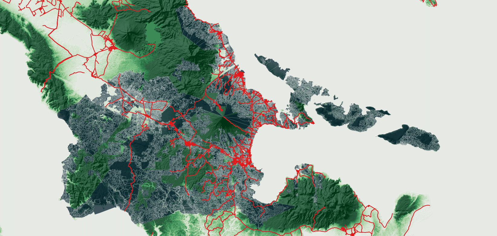
Quantum Geographic Information System

GovGeoTechSolutions
Welcome to GovGeoTechSolutions
Your premier destination for tailored geospatial solutions for Local Government Units. Specializing in QGIS-based solutions, we provide an extensive range of services tailored to address the distinct requirements of Local Government Units in the geographical sphere.
GovGeoTech Solutions
Explore and Discover how GovGeoTechSolutions can help your LGUs now!

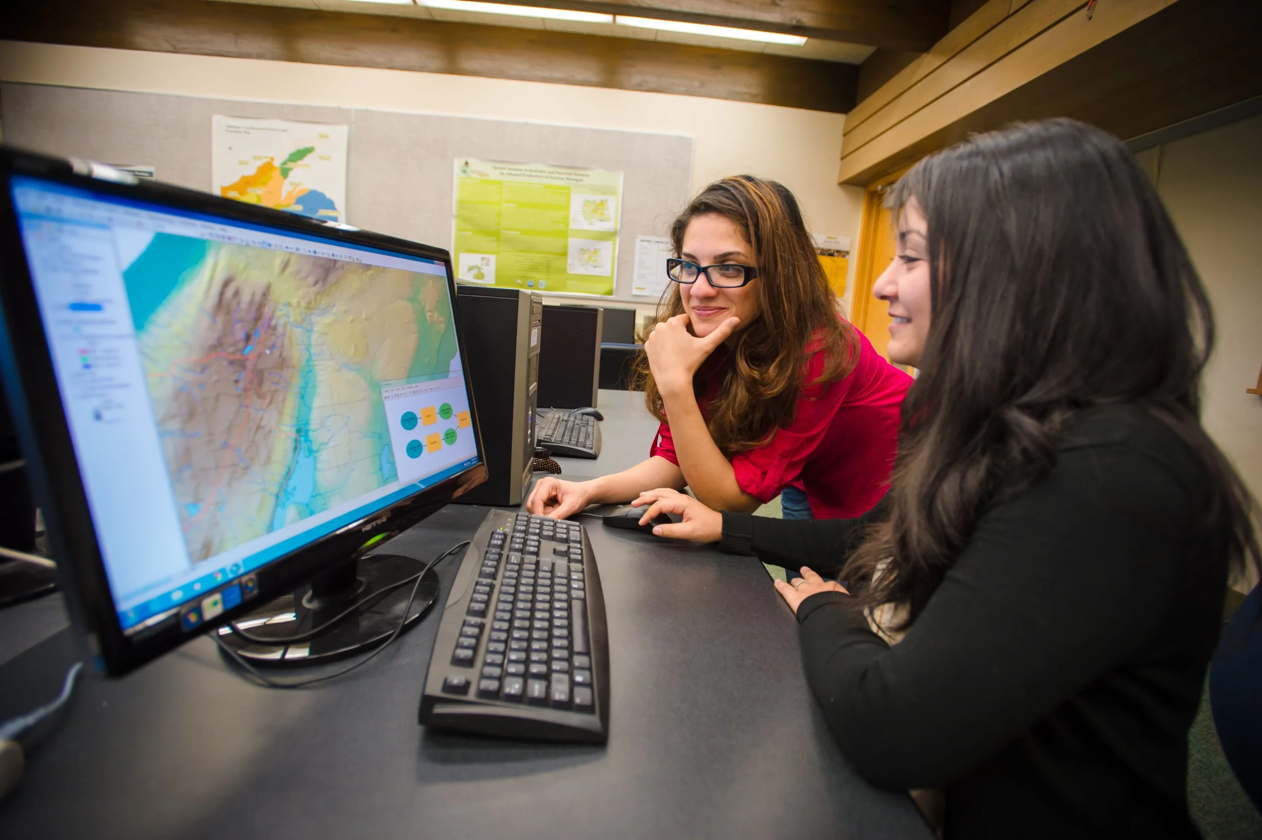
About GovGeoTechSolutions
At GovGeoTechSolutions, our core mission is to spearhead a transformative shift in how government entities leverage geospatial technology. We are driven by the imperative to equip governments with the requisite tools and insights to facilitate informed decision-making and bolster public services. With a team comprising seasoned industry experts and an unwavering commitment to excellence, we endeavor to serve as the go-to partner for government agencies seeking to harness the potential of location-based data.
Portfolio GovGeoTechSolutions
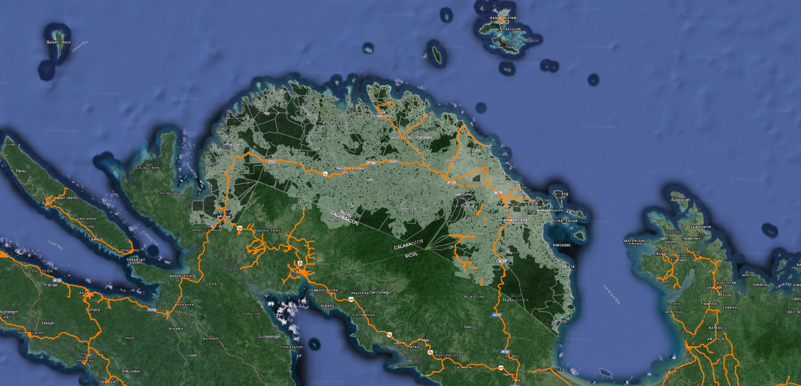
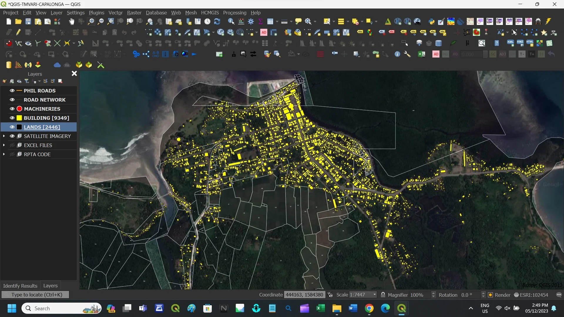
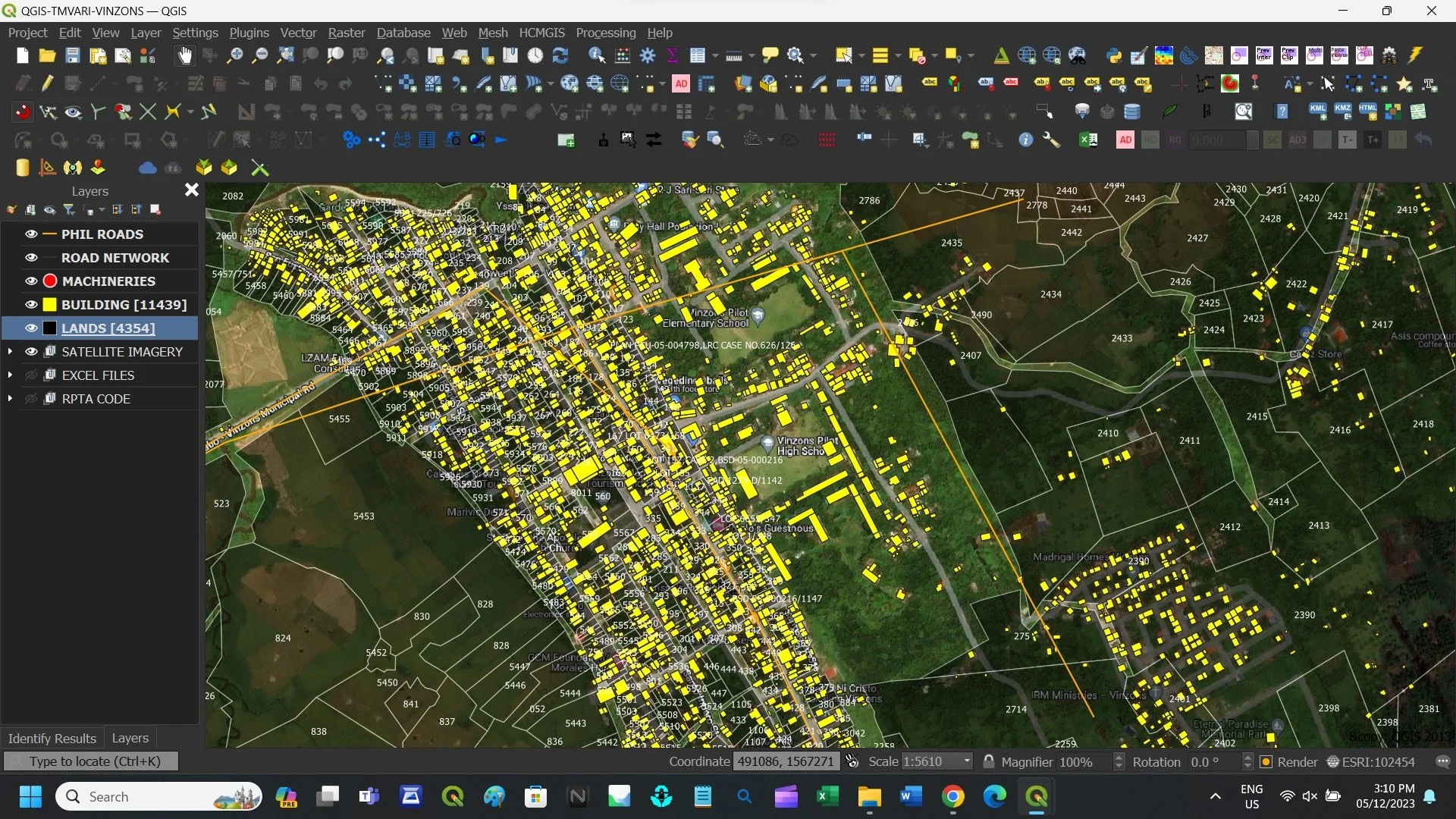
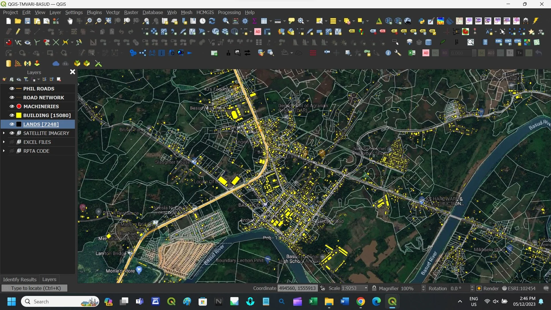
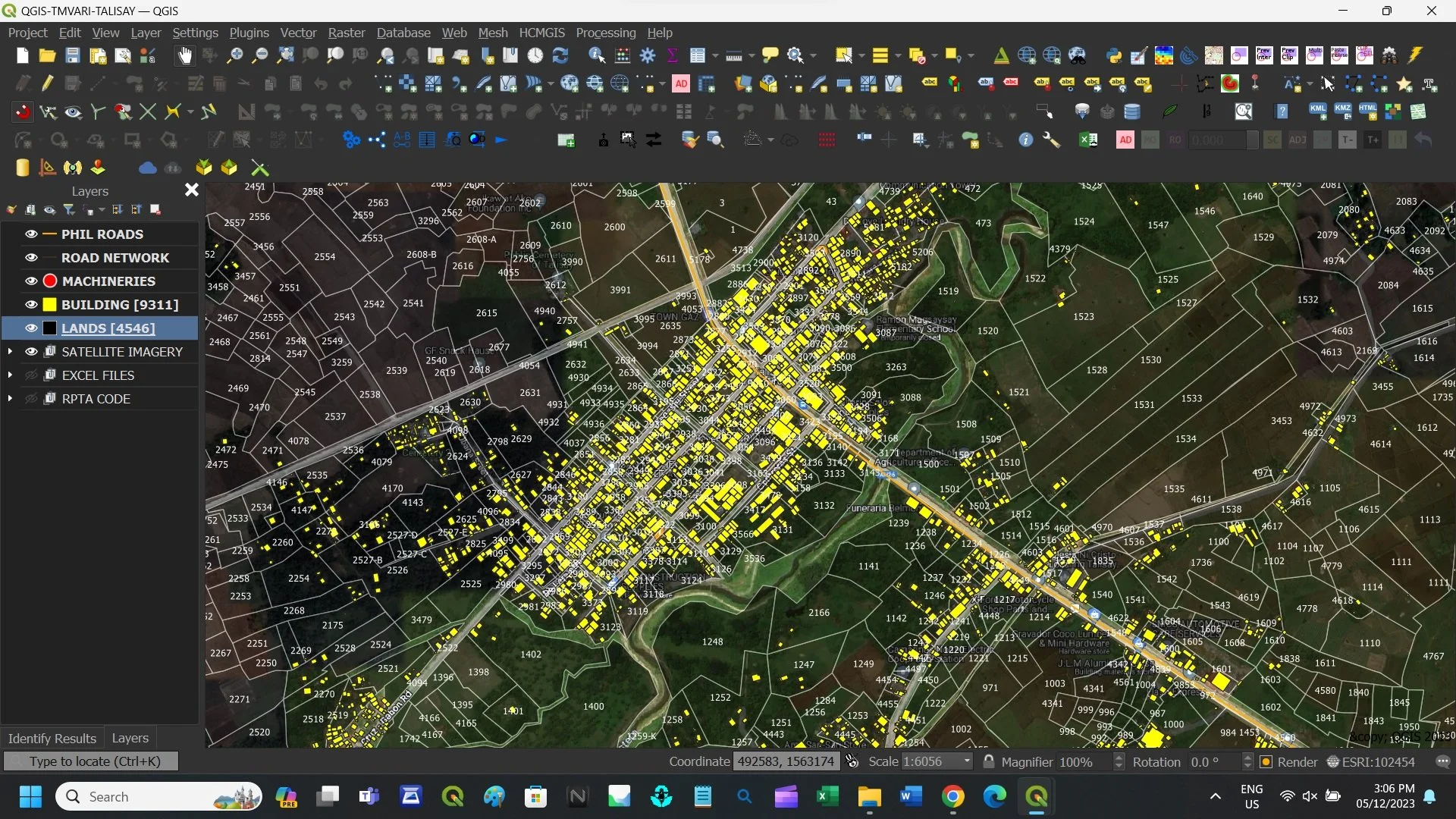
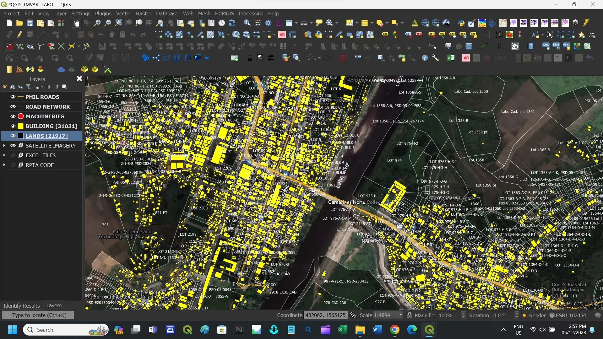
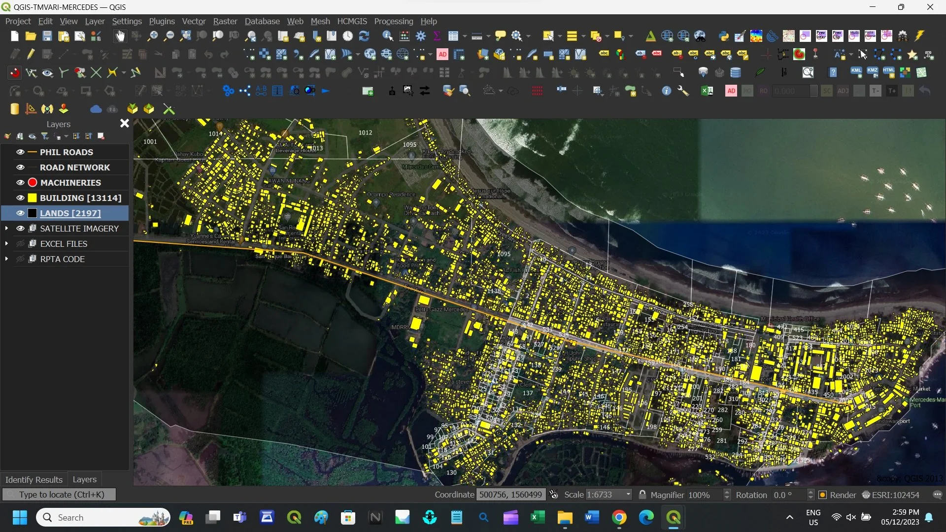
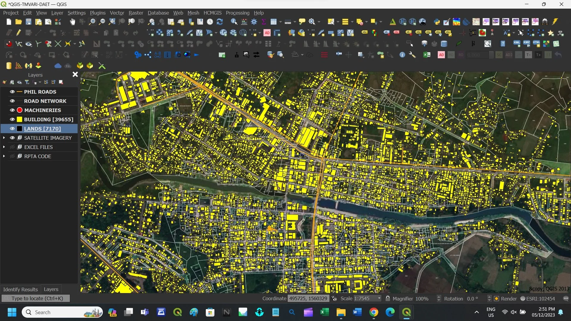
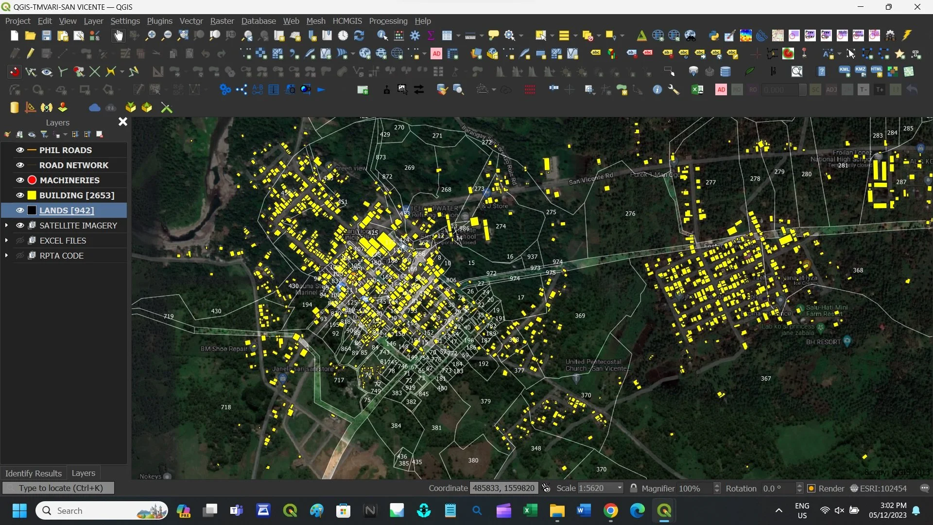
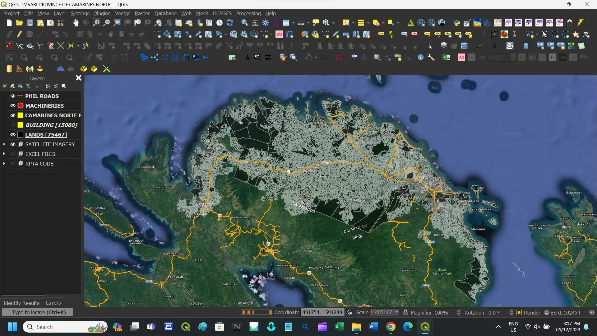
Here at GovGeoTechSolutions, our portfolio encompasses the entire Region V Geopackage, which includes six provinces: Albay, Camarines Sur, Camarines Norte, Catanduanes, Masbate, Sorsogon including all component and chartered CITIES of the Bicol Region…
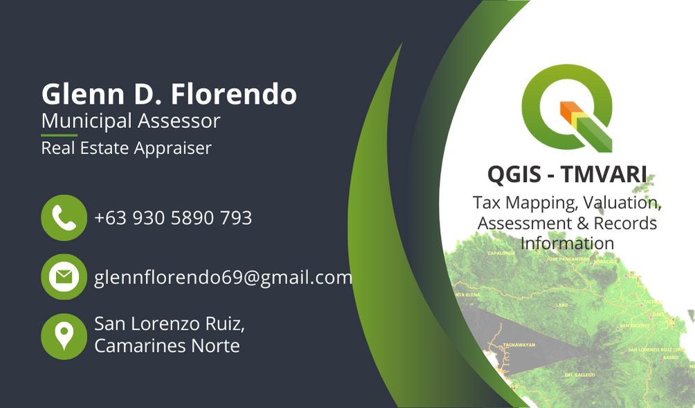
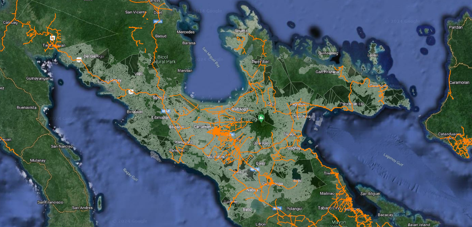
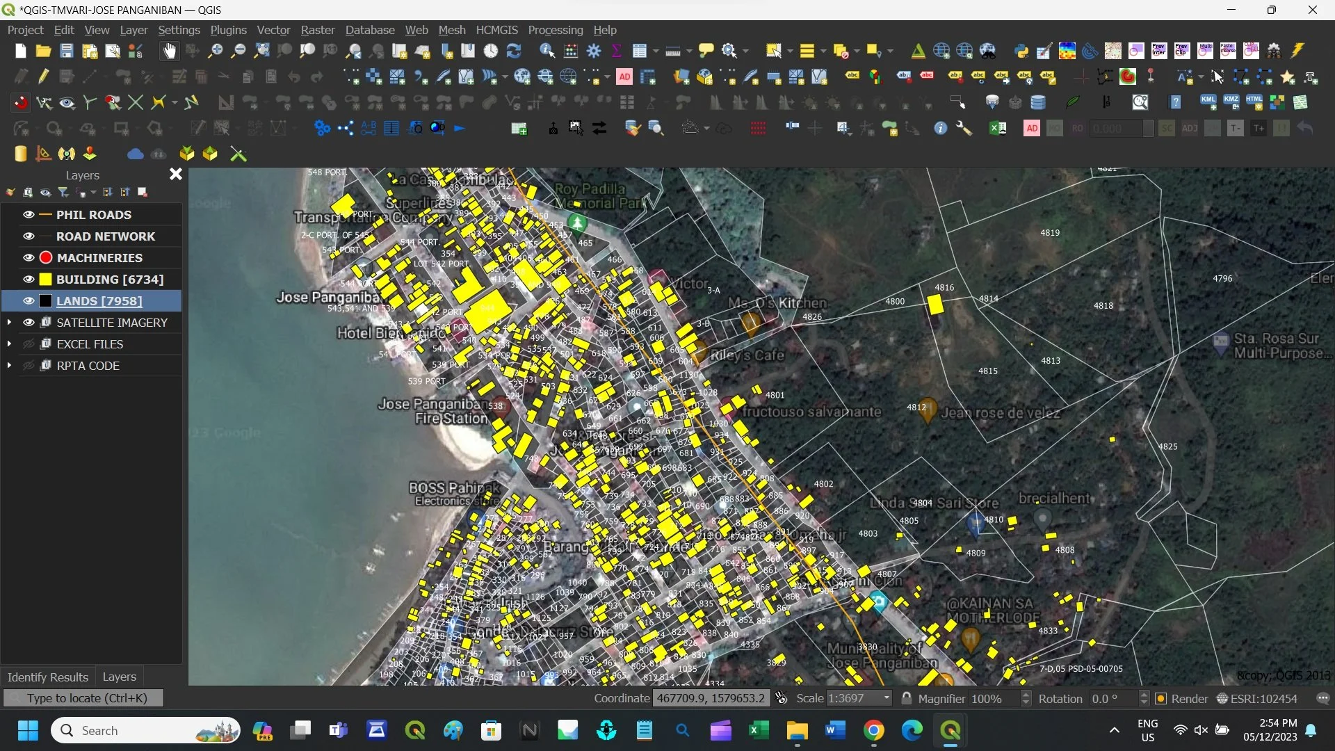
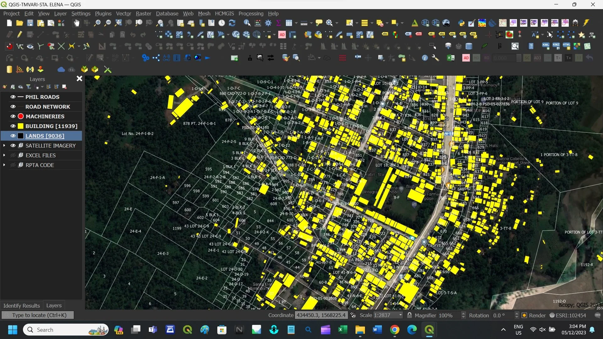
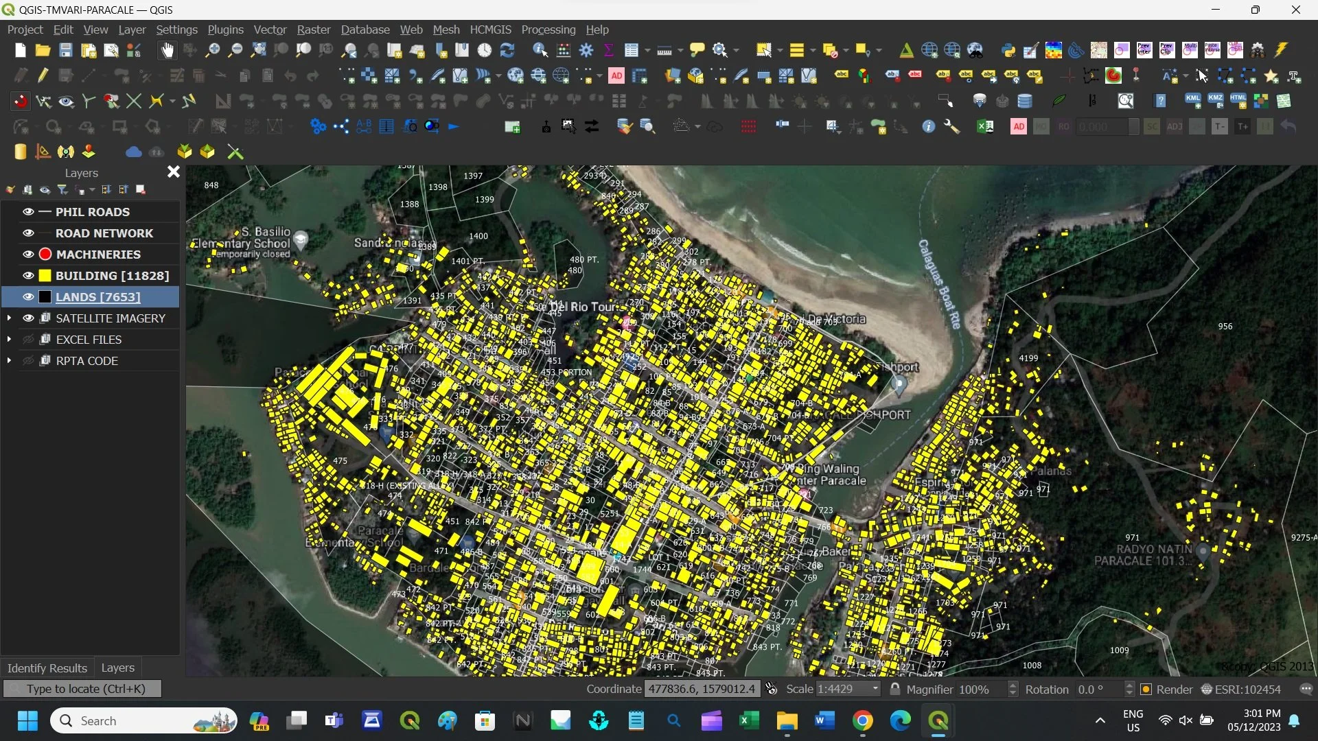
PROVINCE OF CAMARINES NORTE
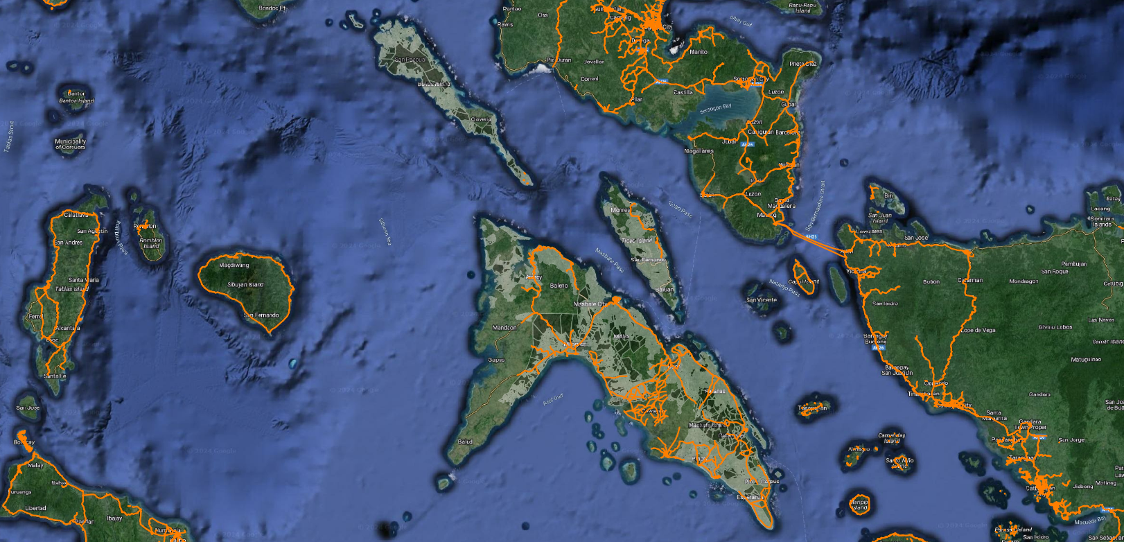
PROVINCE OF MASBATE
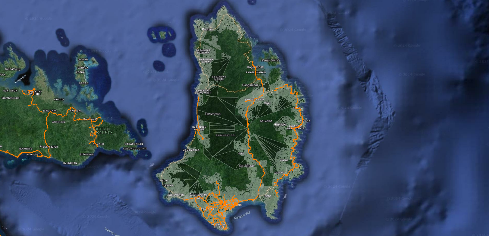
PROVINCE OF CATANDUANES
PROVINCE OF CAMARINES SUR
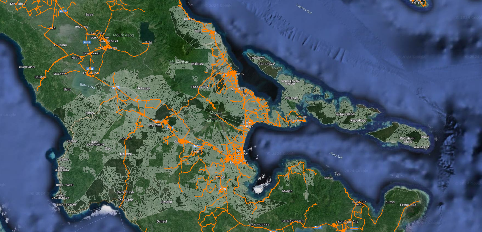
PROVINCE OF ALBAY

PROVINCE OF SORSOGON
Key Benefits GovGeoTechSolutions
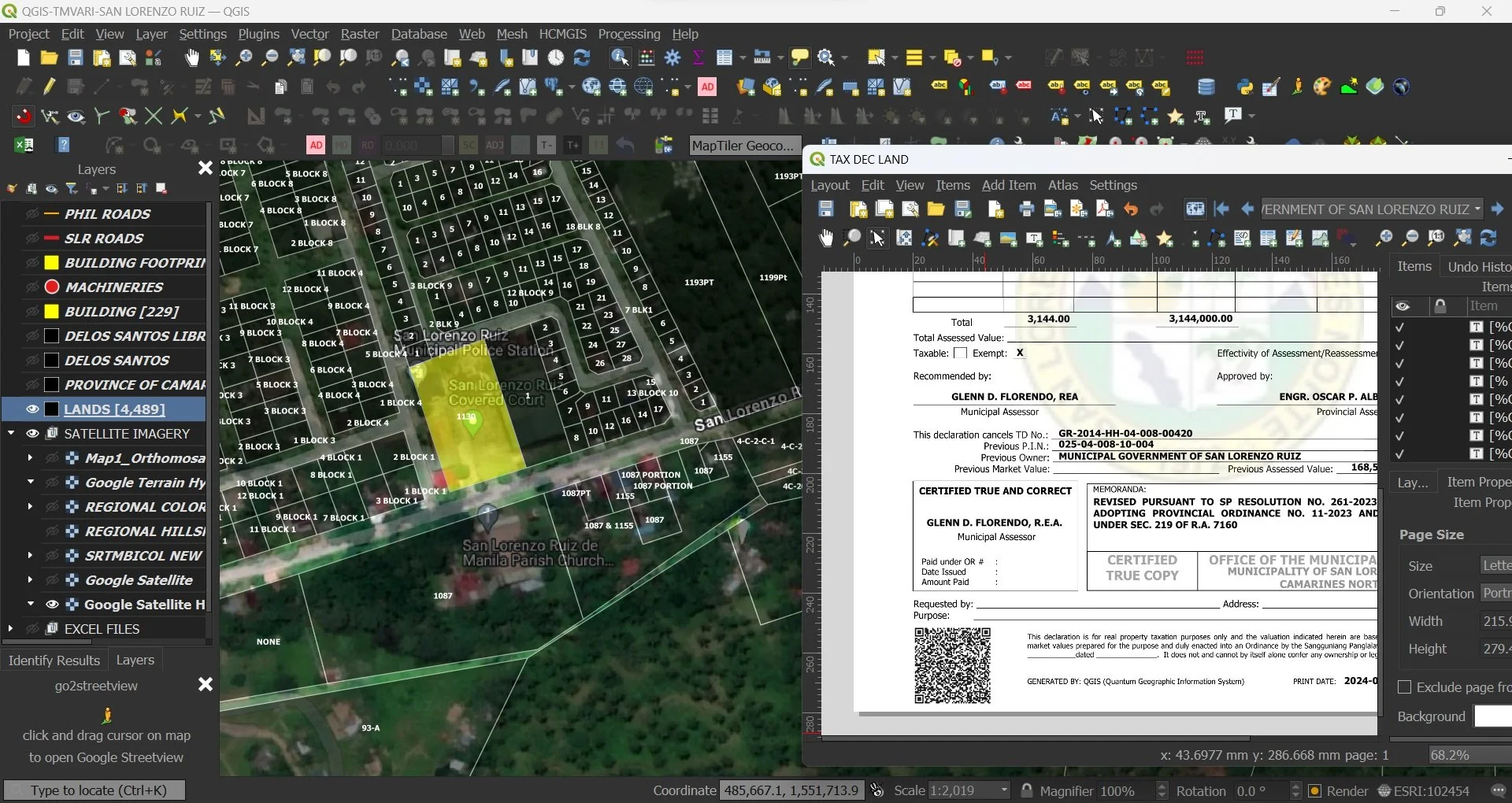
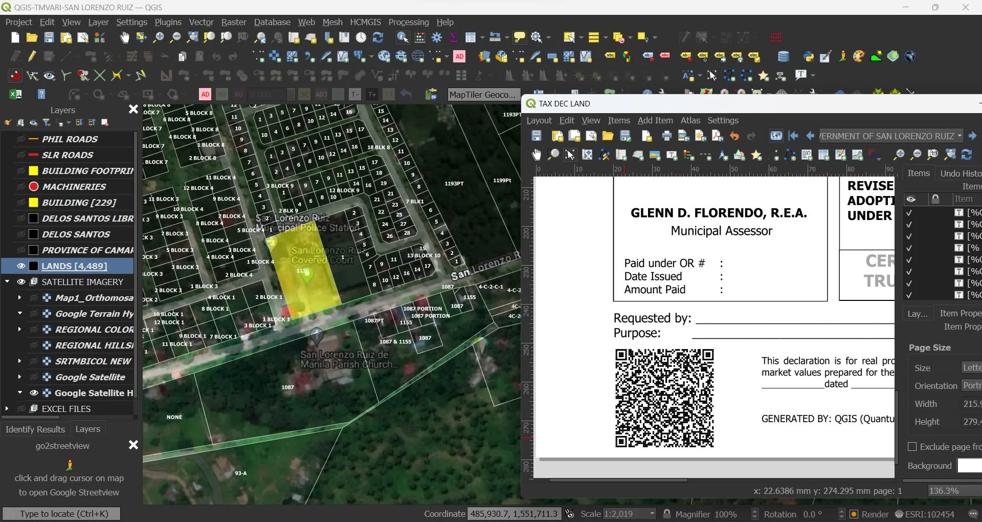
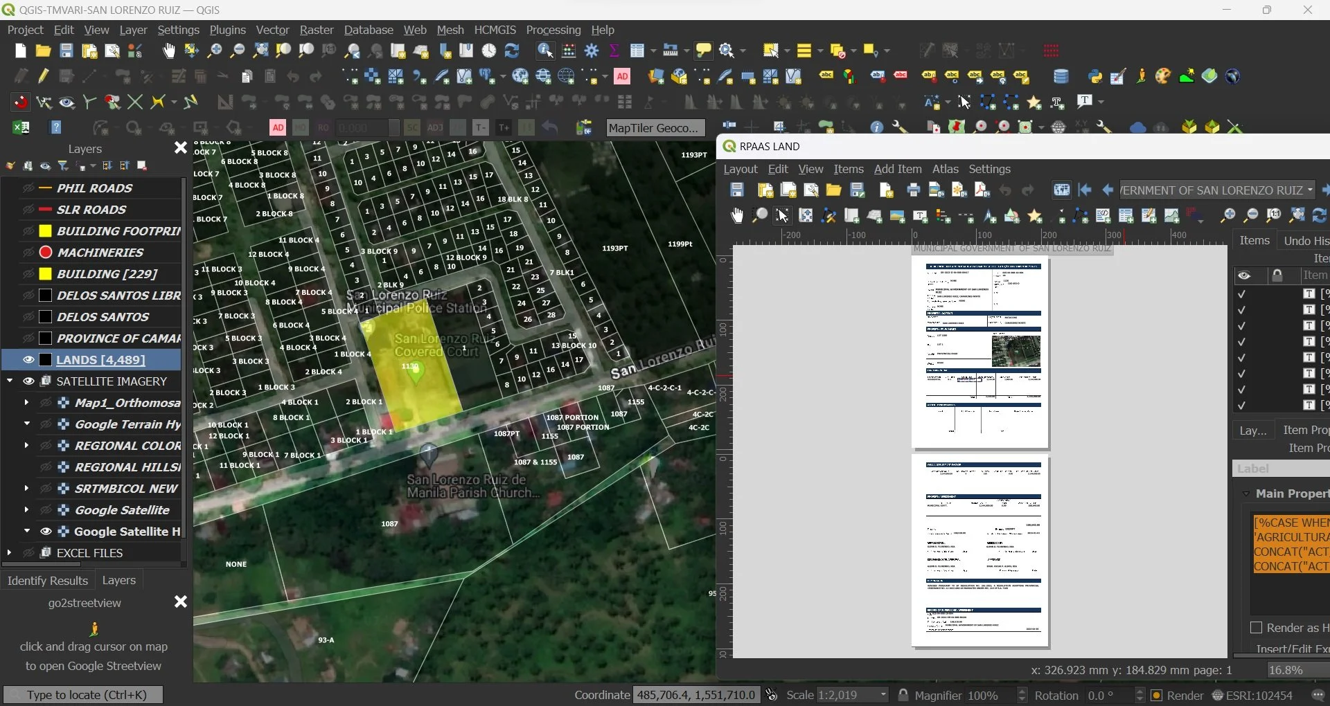
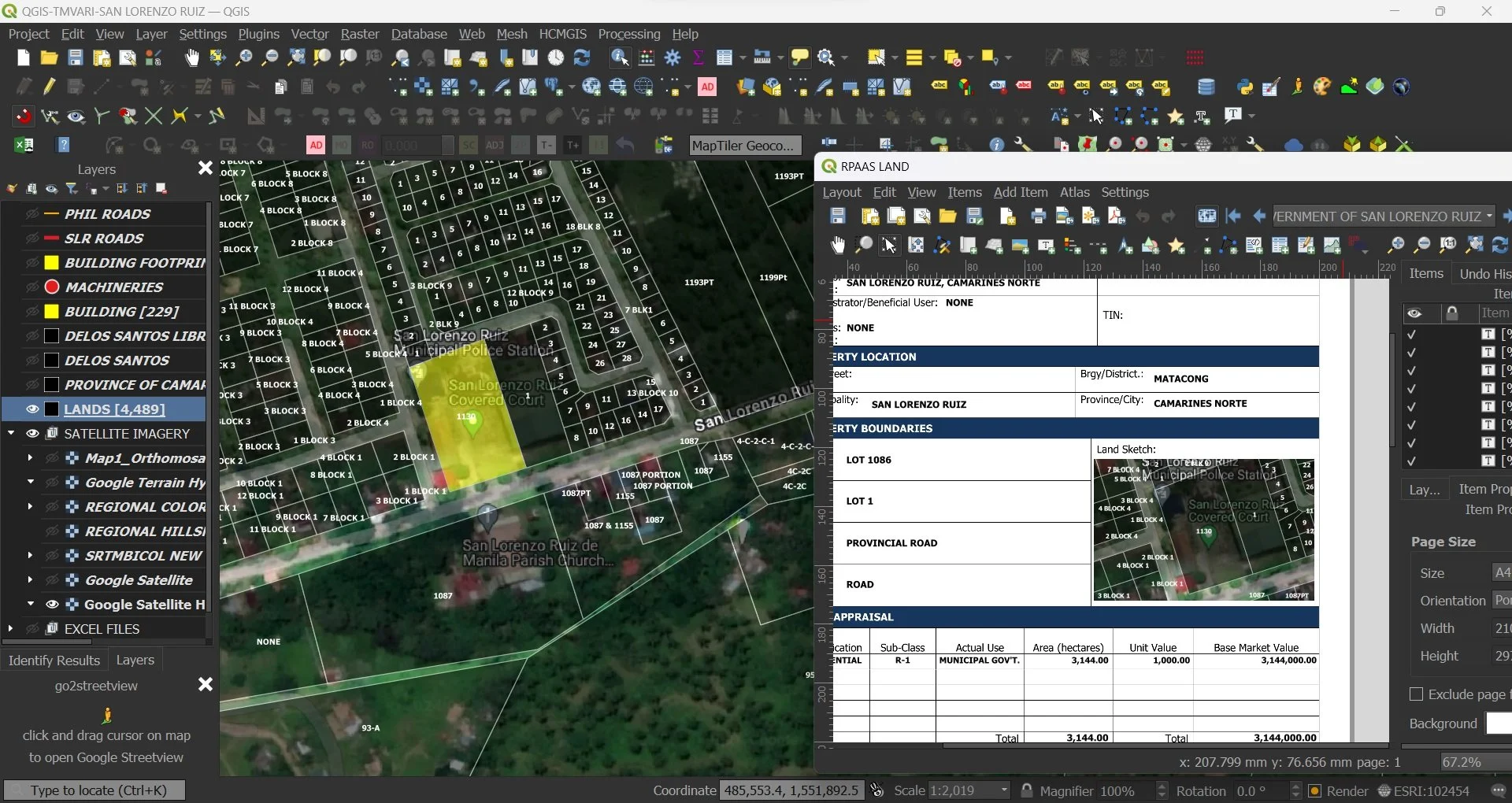
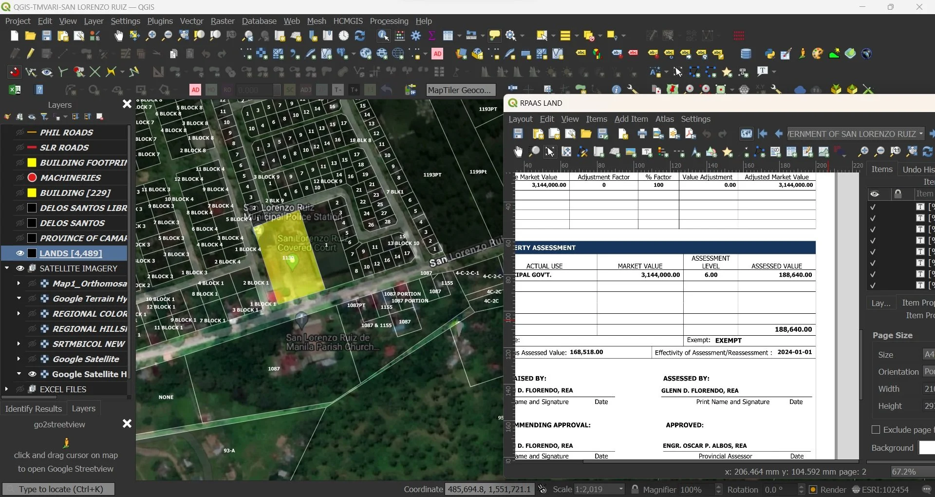
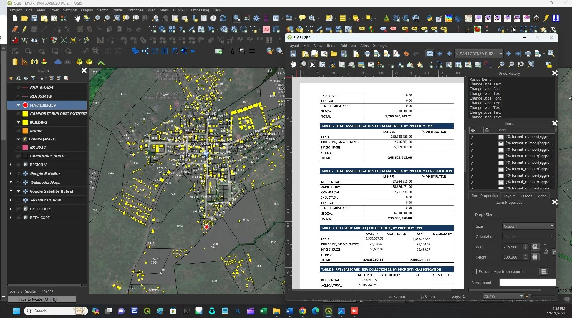
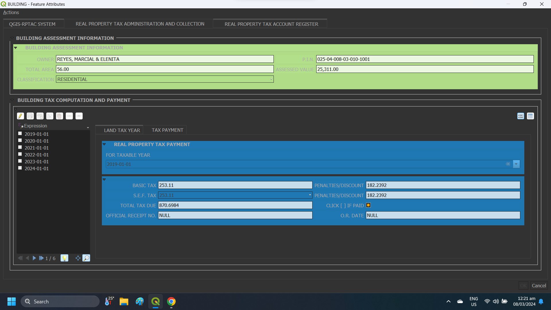
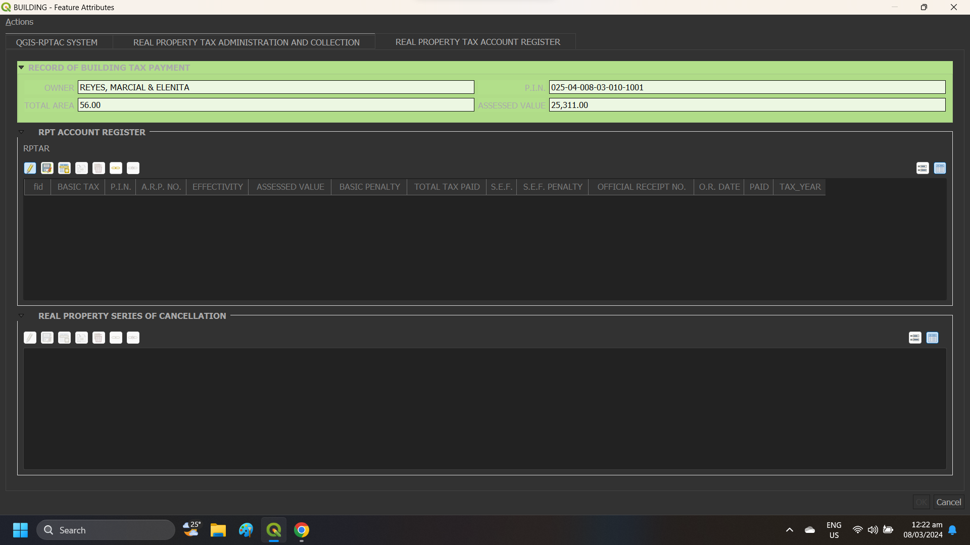
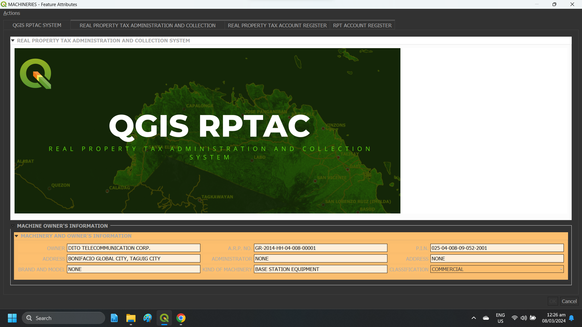
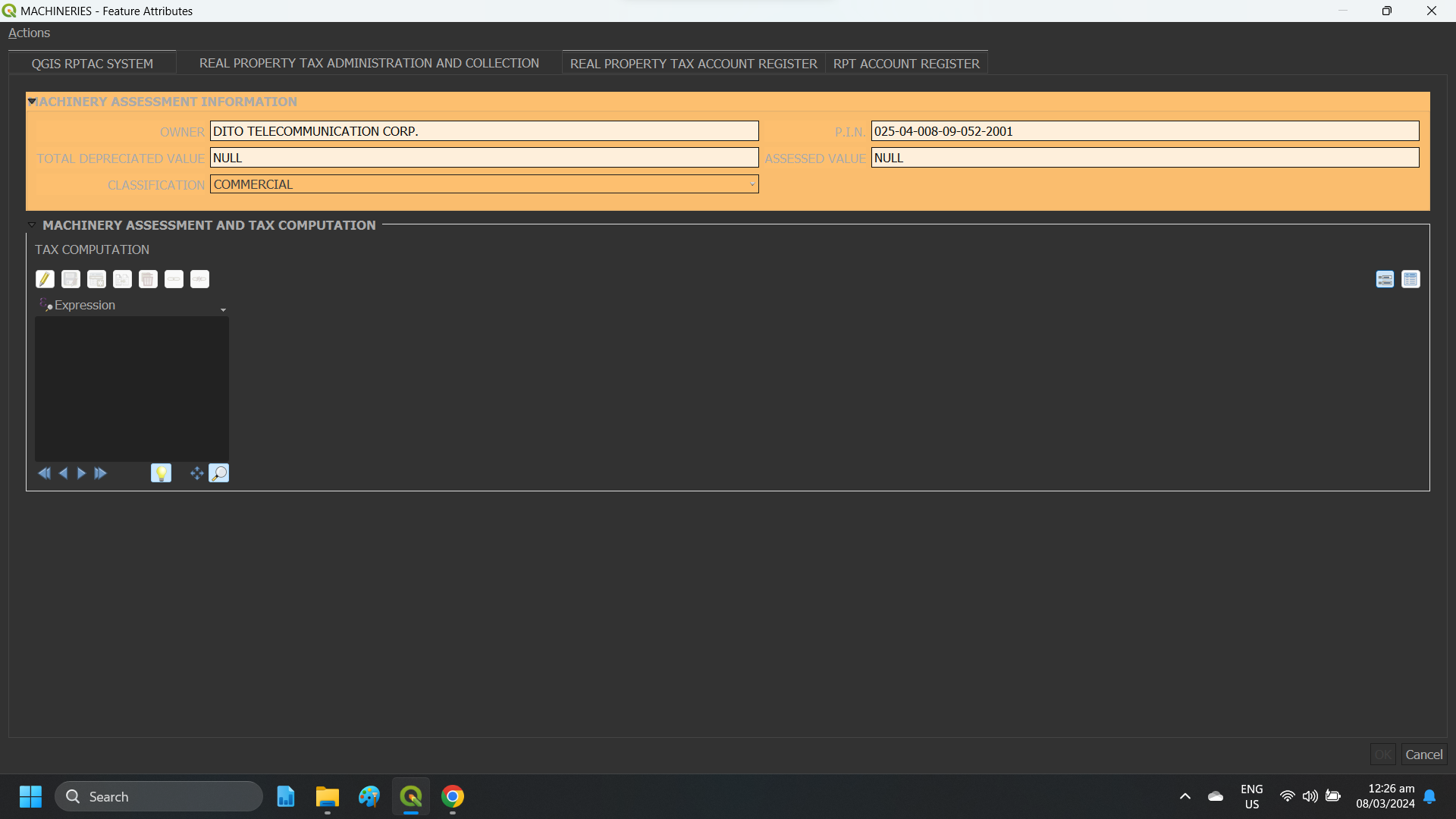
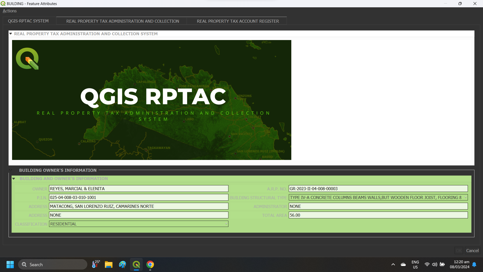
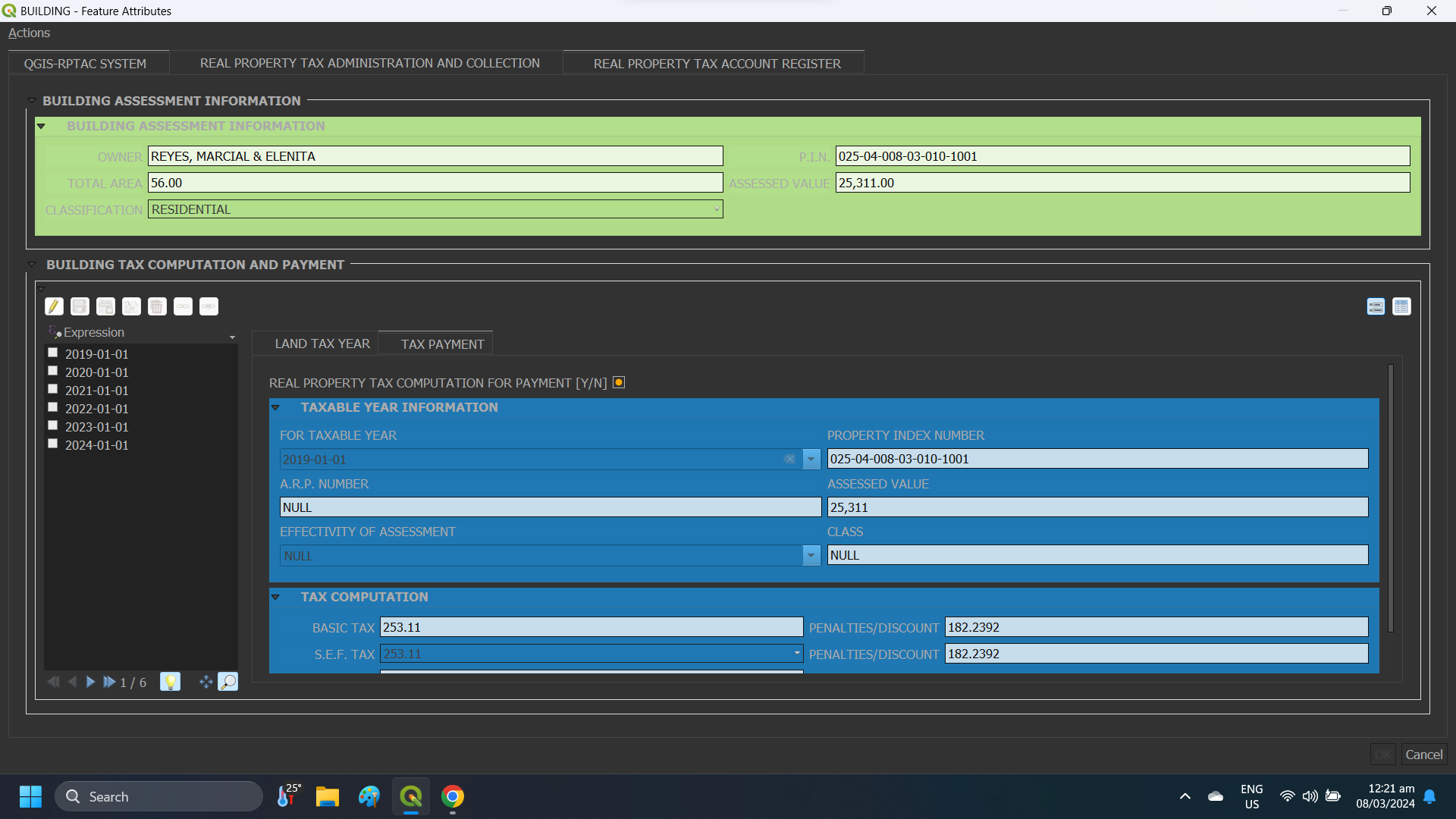
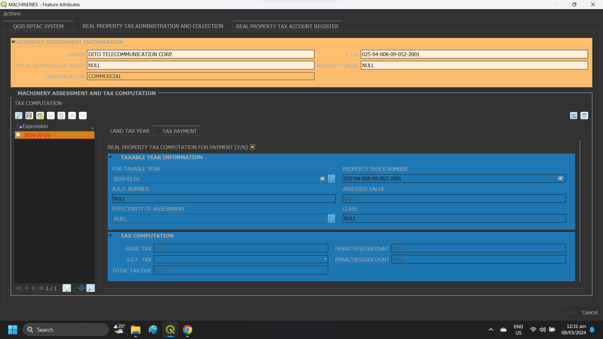
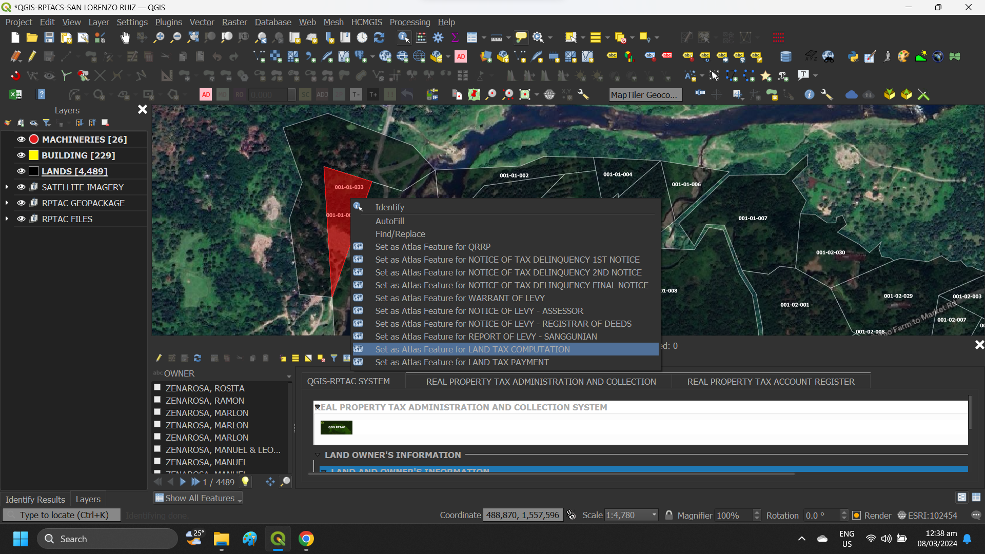
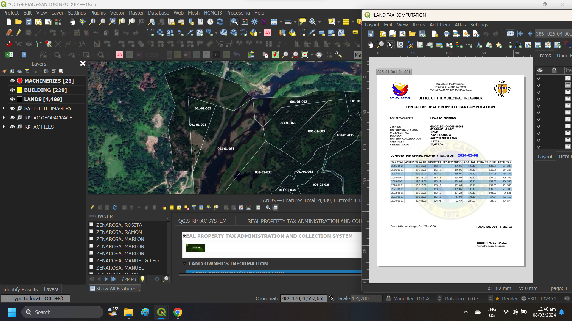
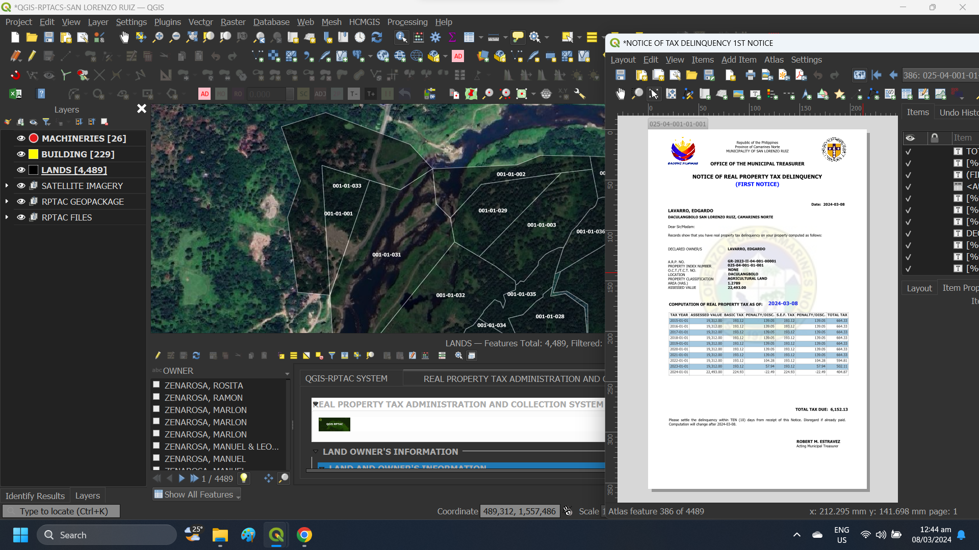
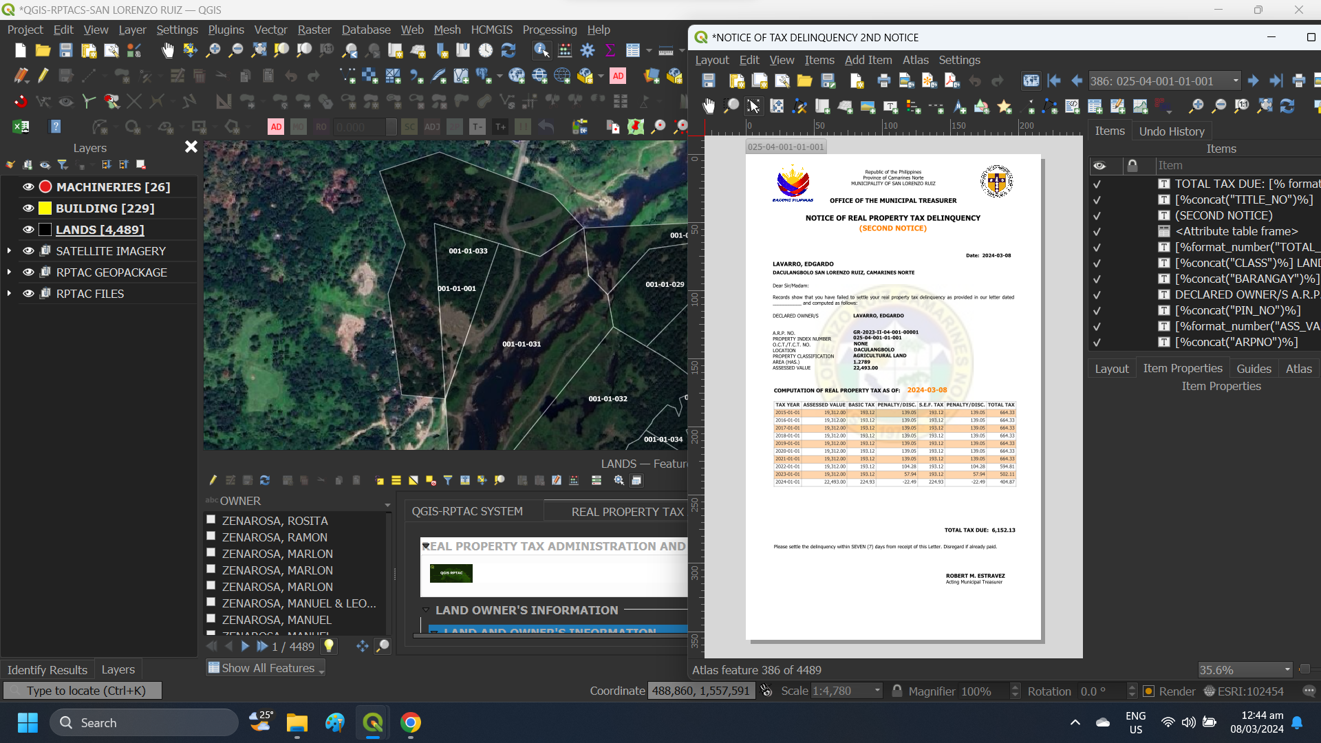
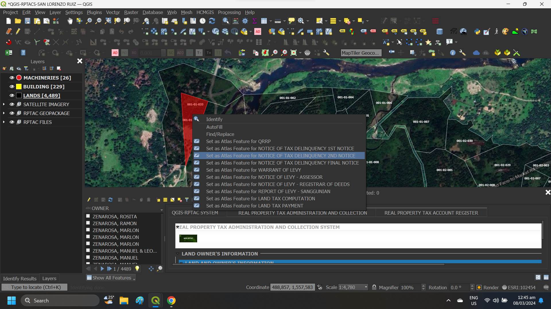
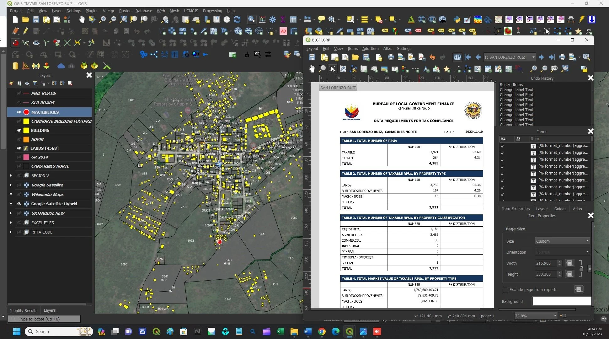
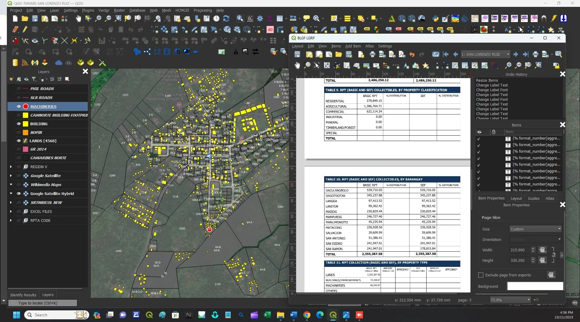
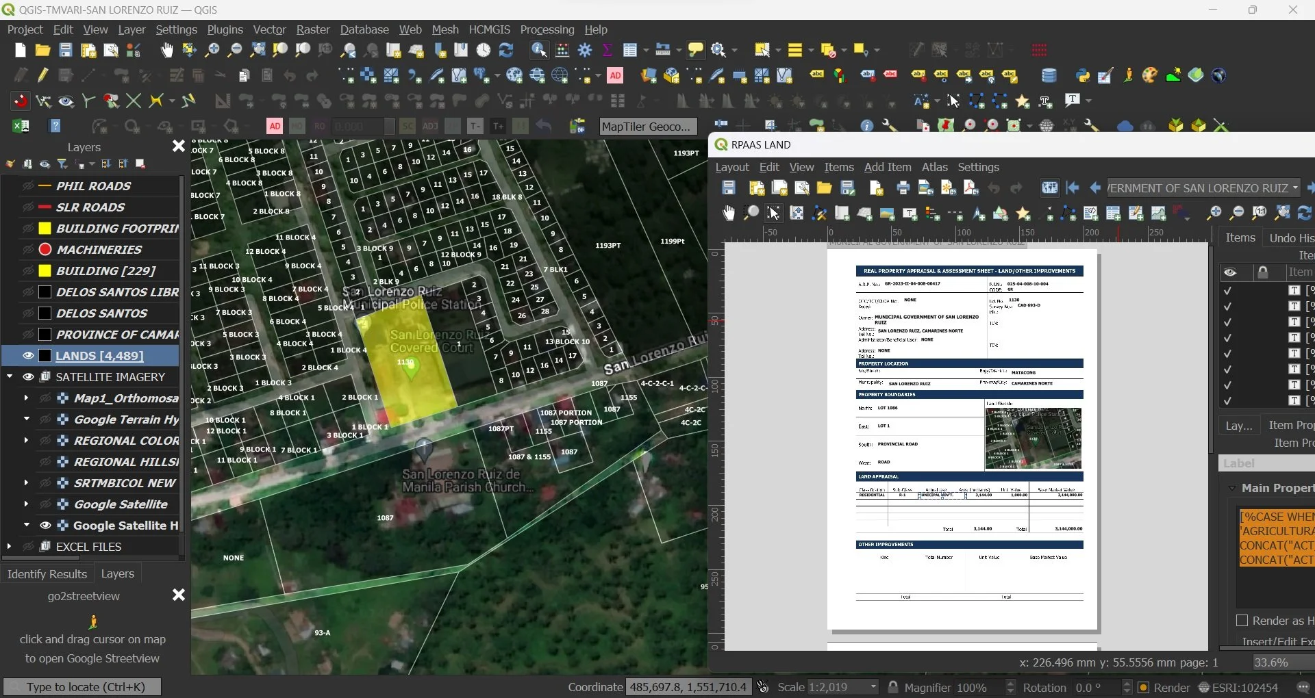
Harness the power of QGIS-TMVARI and QGIS-RPTACS to elevate your work with digital precision and impeccable records management.
Enjoy unparalleled efficiency through the seamless integration of assessment records with tax collection records, complete with instant report generation.
Prepare to revolutionize your workflows—QGIS-TMVARI and QGIS-RPTACS provide unmatched accuracy and ease, setting the stage for smarter and more efficient public service.
Unlocking Potential

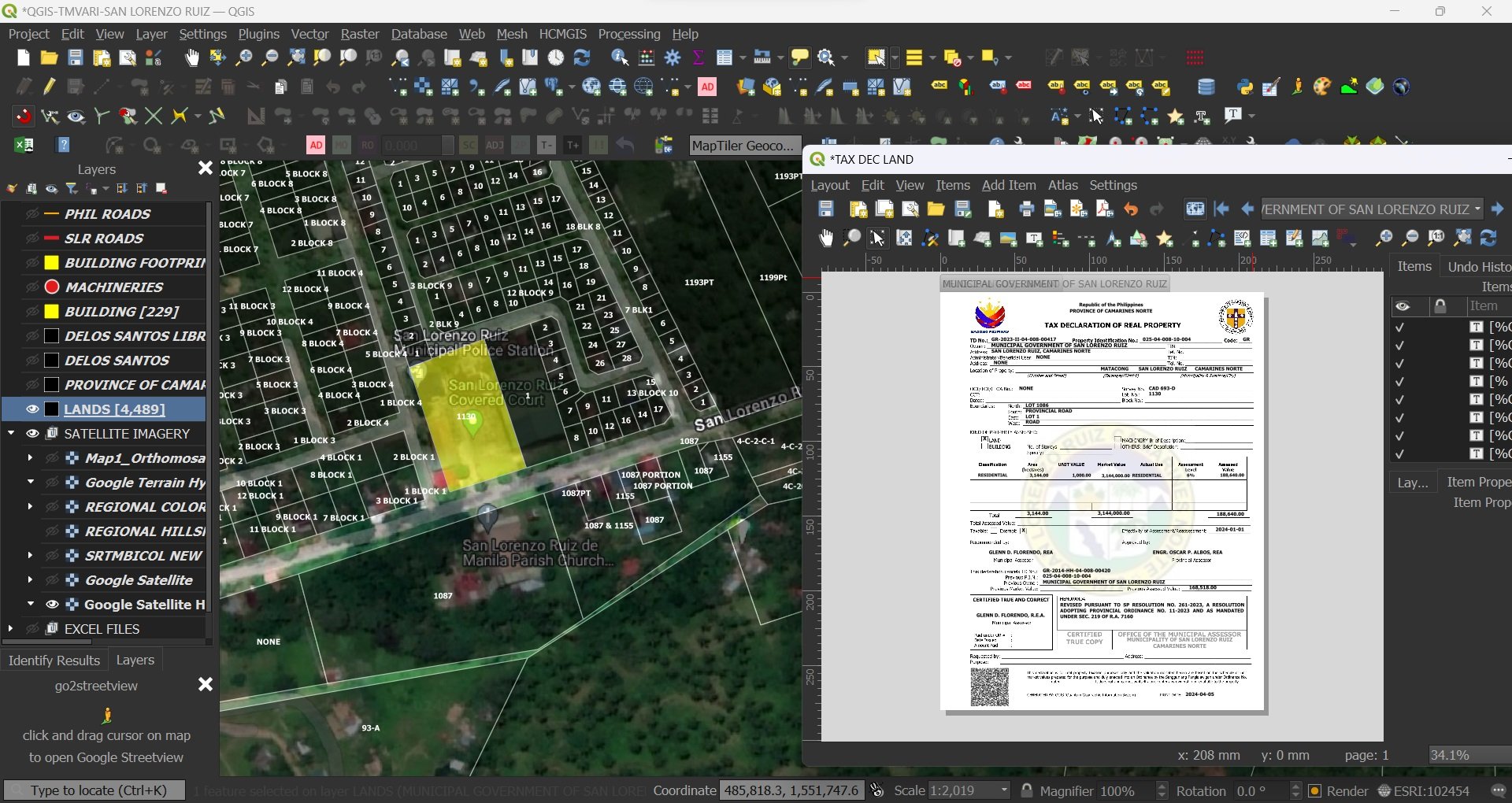
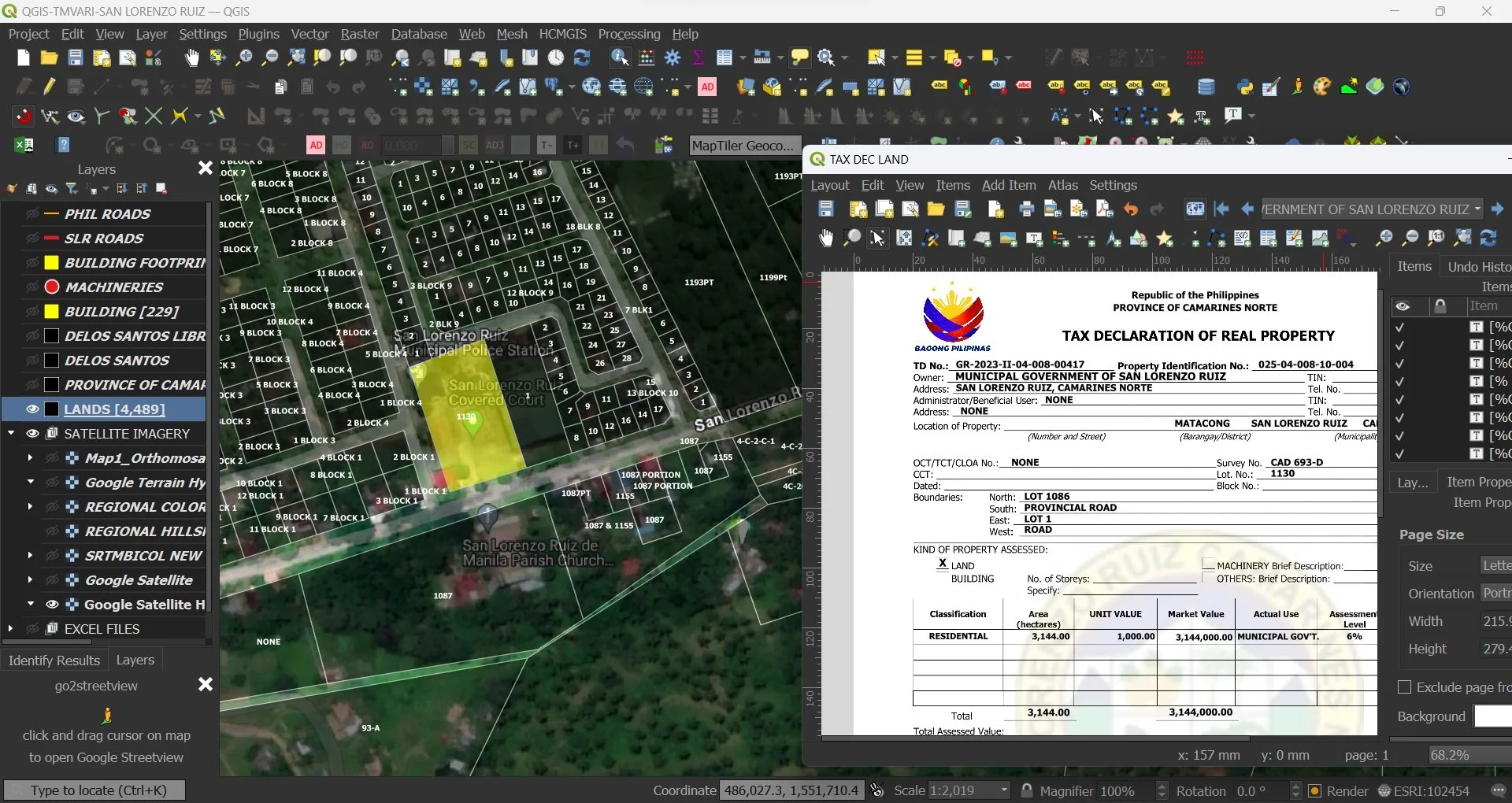
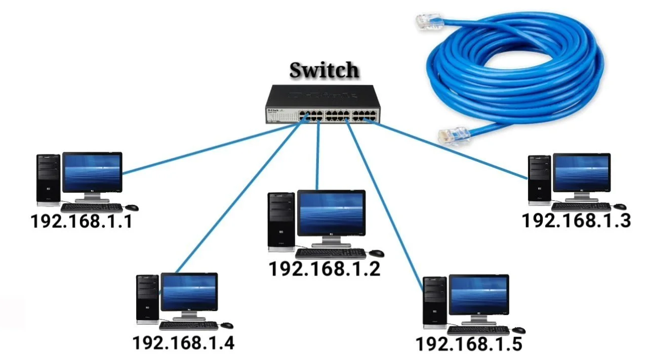
Increase your efficiency and streamline your workflow by leveraging the combined capabilities of QGIS-TMVARI and QGIS-RPTACS through networking or LAN. Working seamlessly together, these systems not only help you work better and make informed decisions but also significantly enhance the quality of your output. Elevate your productivity and achieve more by harnessing the full potential of these robust tools using your QFIELD professional mobile data collection app for Android, iOS, and MacOS.


Digital Precision

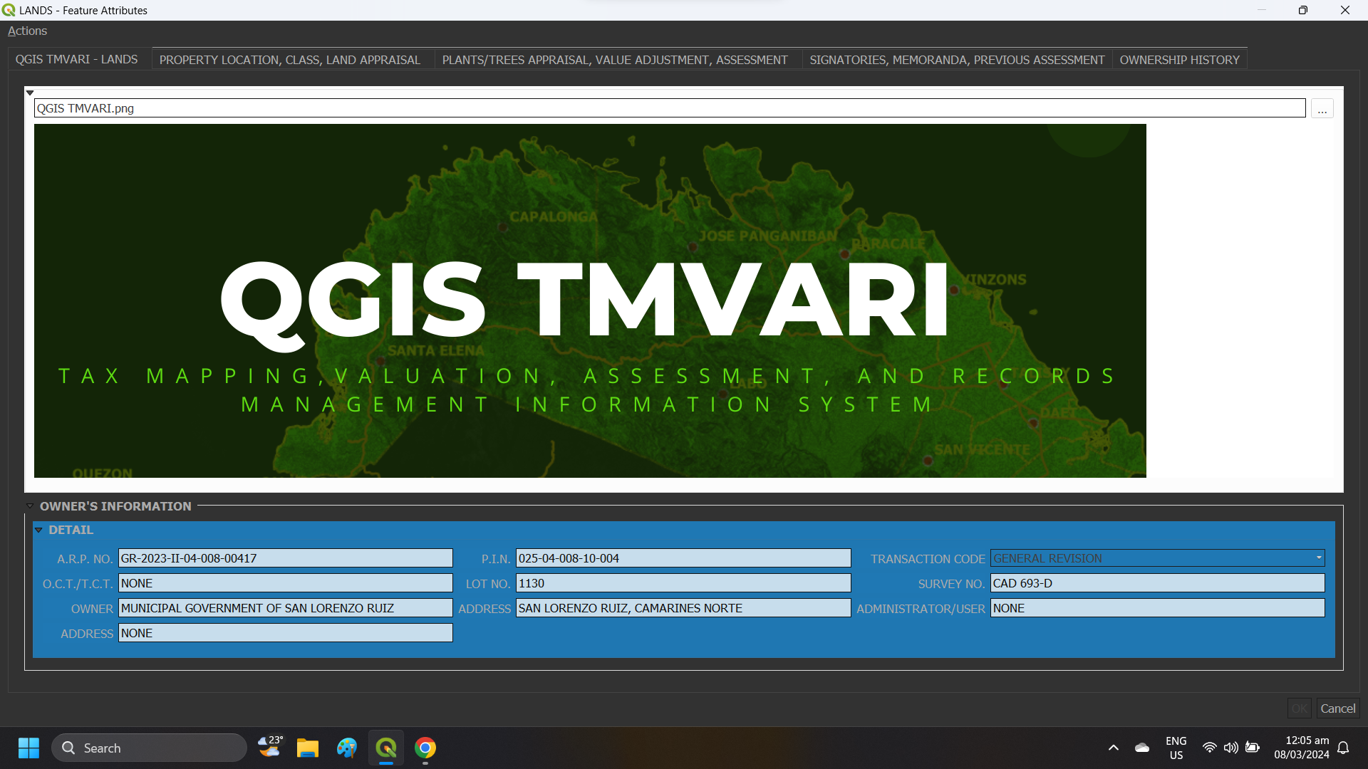
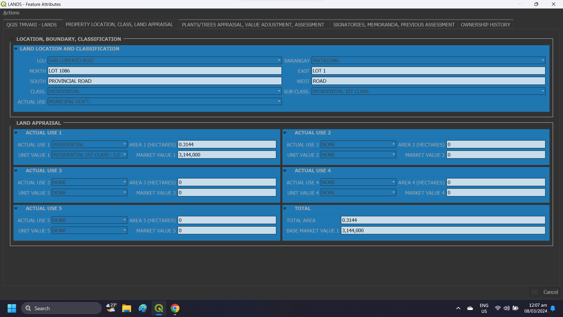
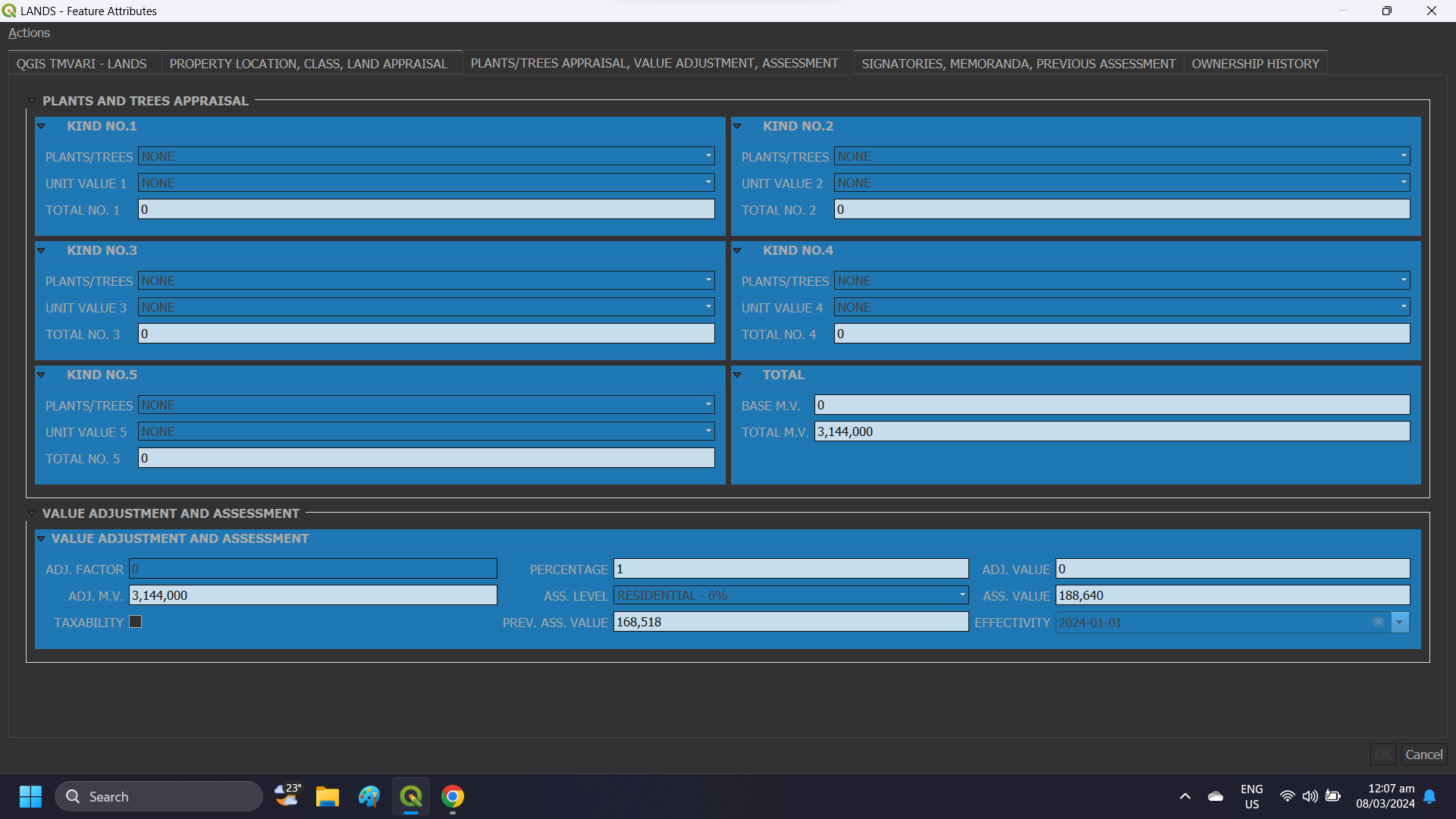
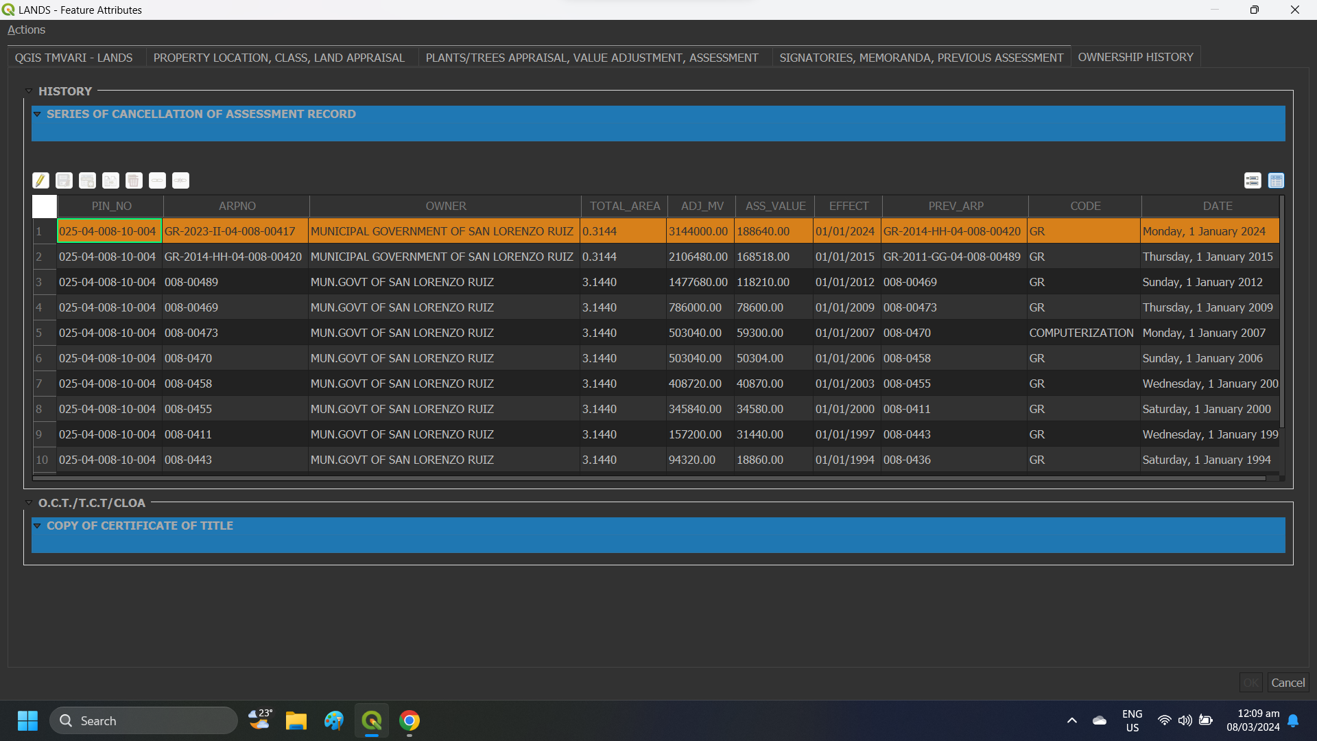
Embrace the future of mapping with QGIS-TMVARI, an innovative tool that ensures accurate digital mapping. This software paves the way for streamlined processes, enhancing data precision and efficiency in geospatial applications. With its user-friendly interface and advanced features, QGIS-TMVARI revolutionizes the way spatial data is managed and analyzed. Its compatibility with various data formats makes it a versatile solution for professionals across industries.
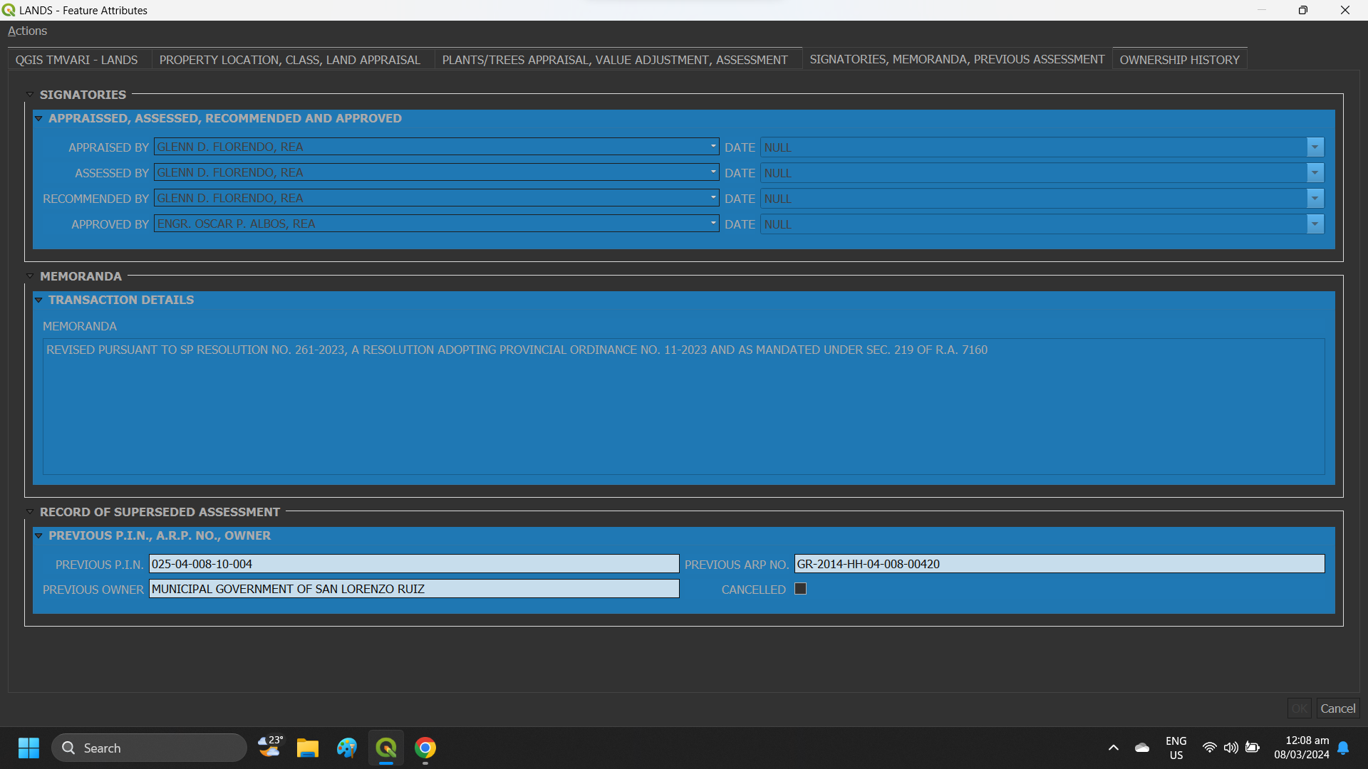
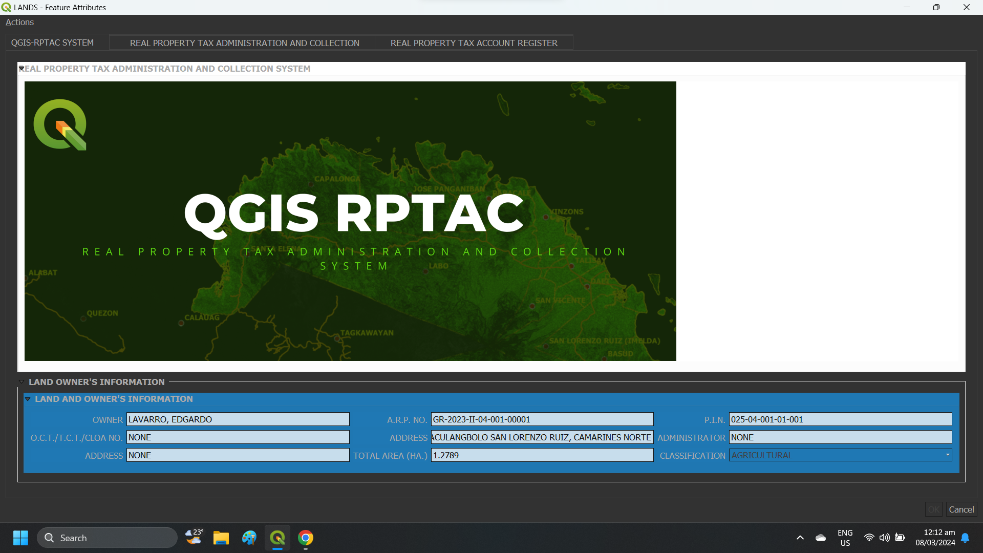
Records Perfection

Say goodbye to inaccuracies with the innovative solutions offered by QGIS-TMVARI and QGIS-RPTACS. These cutting-edge tools guarantee impeccable records-keeping practices, ultimately enhancing transparency and reliability in your assessment and tax collection data.
With these state-of-the-art technologies at your fingertips, you can streamline your processes, improve data accuracy, and ensure compliance with the latest industry standards, paving the way for more efficient operations and informed decision-making.


Efficiency Redefined

Enhance your operational efficiency with our cutting-edge system meticulously crafted to simplify and optimize real property tax management processes.
Tailored to streamline operations and save you precious time, our innovative solution is designed to boost productivity effectively.
Seamless Integration
QGIS-TMVARI and QGIS-RPTACS are designed to seamlessly integrate into your current systems without causing disruptions. This seamless integration ensures that you can quickly start reaping the benefits of these advanced mapping technologies without any hassle.

Ready to Transform

Don’t miss out on the digital revolution. Discover how QGIS-TMVARI and QGIS-RPTACS are equipped to revolutionize your municipality, elevating it into a realm of unparalleled efficiency and precision.