Empowering Tomorrow's Landscapes: Harnessing QGIS for Comprehensive Land Use Planning
QGIS-CLUP Comprehensive Land Use Plan GovGeoTechSolutions
In light of the increasing impacts of climate change and disasters on communities worldwide, the formulation and adaption of a Comprehensive Land Use Plan that integrates climate and disaster risk assessments has become imperative.
By mainstreaming these assessments into land use planning processes, decision-makers can proactively identify areas prone to natural hazards and climate-related risks, thus enabling the implementation of mitigation and adaptation measures. This approach ensures that future land development is sustainable, resilient, and aligned with reducing vulnerabilities. Through a forward-looking and integrated approach, such a plan can help foster safer and more sustainable communities for generations to come.
QGIS-CLUP offers a robust suite of tools for data collection, integration, and analysis, enabling local governments to develop CLUPs that are accurate, sustainable, and inclusive. From creating base maps to defining land use zones and conducting spatial analysis, QGIS empowers planners to make informed decisions and engage stakeholders effectively.
With QGIS, implementing and monitoring CLUPs becomes streamlined, facilitating adaptive management and promoting resilient communities. Join us in harnessing the power of QGIS for comprehensive and sustainable land use planning.
Partner LGU DEL GALLEGO, CAMARINES SUR GovGeoTechSolutions
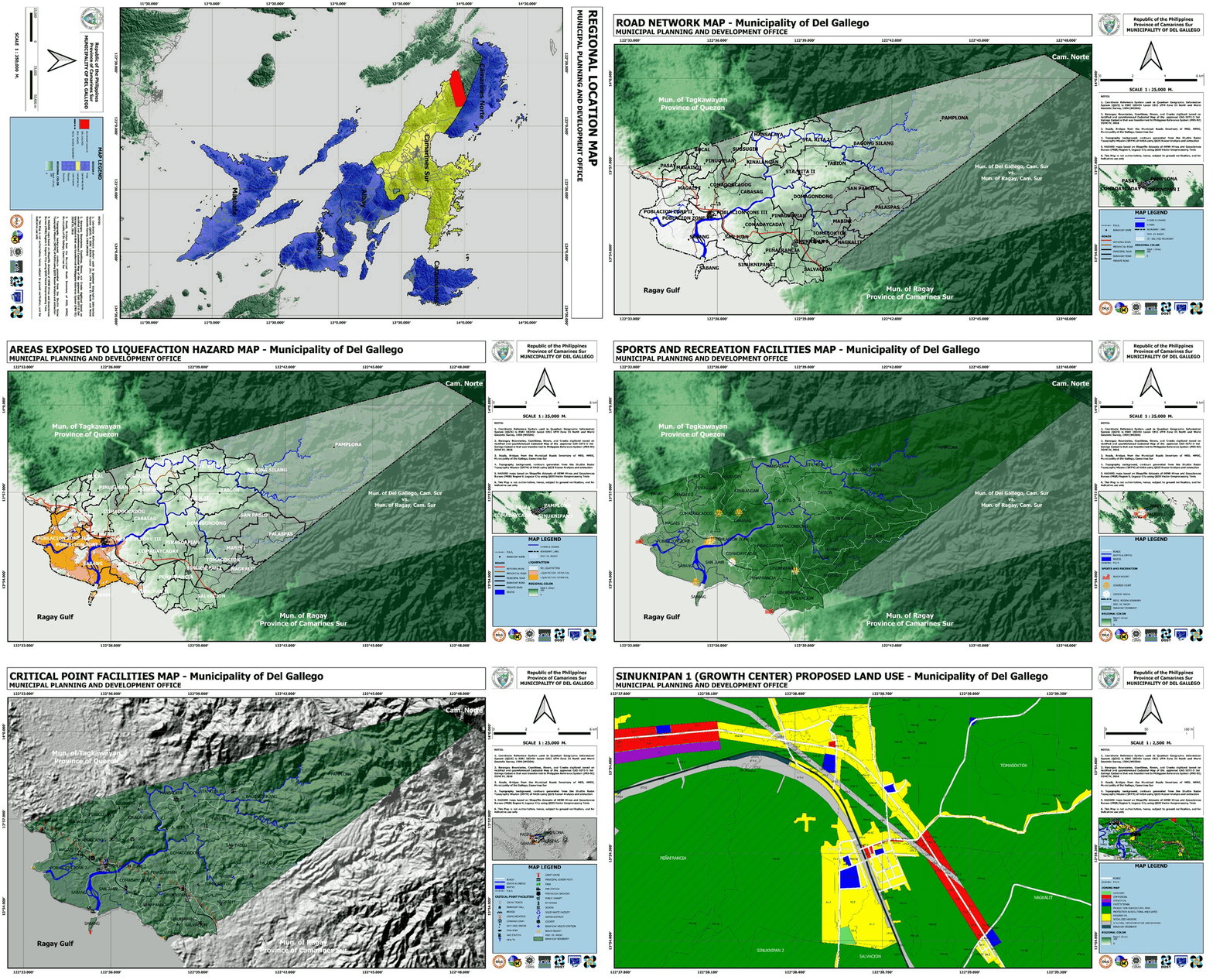
QGIS-CLUP system generated maps GovGeoTechSolutions

MAP ATLAS
It plays a crucial role in Comprehensive Land Use Plan (CLUP), serving as an indispensable tool for urban and regional planning.
Essentially, a Map Atlas is a comprehensive collection of maps that provide a visual representation of various aspects of land use and spatial organization within a specific geographic area, typically a municipality, city, or region.
These maps are not just ordinary cartographic representations which are drawn manually on a classical paper-based mapping; instead, they are meticulously designed, digitized, and processed in a computer-based platform, the ever-popular QGIS (Quantum Geographic Information System) to depict a wide range of information critical for land use planning.


